

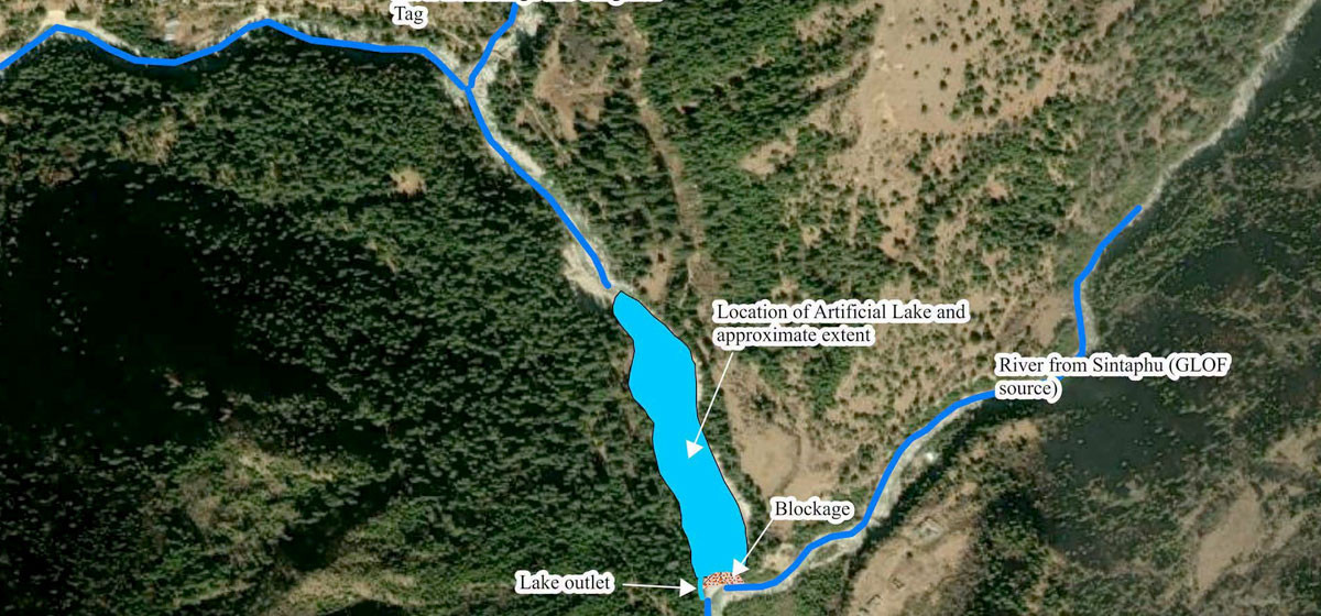
Kathmandu. Vigilance has been adopted in the lower coastal areas of India’s West Bengal and Assam states after the floods caused by the explosion of Sintafu Himalaya in Bhutan. In view of the growing Himalayan risks in the Hindu Kush Himalayan region, experts have emphasized the need to further strengthen effective early warning systems, regular monitoring and cross-border coordination.
According to the statement released today by the International Center for Integrated Mountain Development (ISIMOD), it was estimated that about 60 to 70 million cubic meters of water was stored in Sintafu Lake before the Himtal explosion. This quantity is equivalent to the water that can fit in about 2,400 to 2,800 swimming pools. The actual amount of water released after the explosion has not yet been estimated.
ISIMOD Director General Pema Gyamcho said that the timely warning issued by the Bhutanese authorities confirmed the importance of regular monitoring and an effective early warning system. He mentioned that since disaster events in the Himalayan region are becoming more complex, continuous investment in risk forecasting, preparedness and cross-border cooperation is necessary.
This incident took place after the devastating rock and snow slide in the Girong-Rasuwagadhi area of Nepal last August and the sudden flood in the Budhigandaki area of Gorkha in the last week of October. These incidents have further highlighted the multi-problem risks seen in the Himalayan region and the need to provide timely information.
According to Isimod, in order to reduce the risk of disaster, it is necessary to identify the nature of the risk as well as to understand the risk and sensitivity of the communities living in the lower coastal areas. The organization said that for the early warning system to be effective, the information should reach the affected communities on time and clear information on what to do during the disaster should be available.
An earlier study by ISIMOD and the United Nations Development Program (UNDP) identified 47 major potentially vulnerable glaciers spread across the border in the Koshi, Gandaki and Karnali river basins. So far, 388 flash floods have been recorded in the Hindu Kush Himalayan region.
The National Center for Hydrology and Meteorology, the agency that monitors glacier risk in Bhutan, has been monitoring dozens of potentially hazardous glaciers in the country. In 2015, when the upper watershed of the Mo Chu River, where Sintafu Lake is located, was flooded by a glacial eruption, Bhutanese officials collaborated with the Servir-Himalaya Initiative to assess the risk of glaciers in the watershed.
ISIMOD said that it is working together with regional partners to strengthen the monitoring, forecasting and early warning system for disaster risk reduction in the Hindu Kush Himalaya region. Under this, monitoring of permanent frost (permafrost) in Bhutan’s Laya and Lingji region, development of flood forecasting system in Bhutan, Nepal and Bangladesh and making effective the mechanism for issuing warnings for emergency disasters are being done.
Similarly, ISIMOD said that through Kathmandu 10 action points, initiatives are being taken to speed up risk-related information exchange, early warning standards development and cross-border communication. It is mentioned in the statement that through the Adaptation and Resilience Building Program in the Hindu Kush Himalayan region run with the support of the Asian Development Bank, development of a common data system, expansion of understanding of multi-disaster risks and construction of sustainable infrastructure are also being supported.
ISIMOD emphasized on the need to integrate regular monitoring, timely warning, effective communication and preparedness at the community level to reduce the damage caused by Himalayan disasters such as Himalayan explosions.