

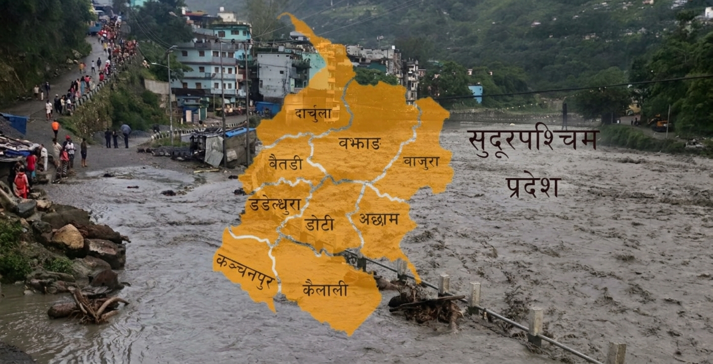
far west On 2nd June 2070, Darchula headquarters, Khalanga, was devastated by the flood along with Gegran in the Mahakali river. 156 houses there were completely damaged, 32 buildings of government offices and belongings of 353 families were swept away. According to government figures, it is estimated that there was a loss of Rs 325.6 million at that time. The conclusion at that time was that such a disaster occurred when there was a ‘cloud burst’ in the upper coastal area of the Mahakali river.
Eight years later, on October 4, 2078, a similar flood occurred in the Seti river in Sigas Rural Municipality-5 Dhungadh of Baitadi. About 150 bigha of arable land was turned into a barren land. Several houses and structures were damaged. In the same year, the entire Far West was affected by unseasonal rains in October. At that time, 12 people died in Pari Doti, four in Baitadi and two in Dadeldhura in landslides after rains. 23 people went missing after the landslide in Thalara of Bajhang and four people went missing after the flood in Lamkichuha of Kailali.
According to Hydrology Office Attaria, 624 mm of rain was measured in 24 hours at Dodhara Rain Measuring Center in Kanchanpur on 24th June 2081. This was the highest rainfall (arighopte rain) in the 78-year period recorded in Nepal. According to the analysis based on satellite images at that time, about 98 square kilometers of the district was inundated, 14,315 houses were affected and the overall damage was about Rs.
These are some representative events of Far West. There have been many tragic incidents of similar disaster risks in various districts here. These risks are not limited to local rainfall or river flows. Rain in the mountains, landslides in the mountains, soil erosion and the flow of water in the rivers have also affected the settlements hundreds of kilometers below. The incidents of Bhotekoshi and Budhigandaki have also highlighted the issue that the disaster in front of them is not the only risk.
This is a serious warning for the Far West as well. The geographical structure, the condition of the infrastructure and the economic-social situation have shown that the situation is more risky. This province is at risk due to multiple disasters from large river systems like Karnali, Mahakali and Seti to the change of the Himalayan region, landslides in the mountainous region, landslides and floods and inundation of Kailali-Kanchanpur, but the task of preparing for these risks in a single system is still challenging.
Disaster from Himtal to Terai
Far West is spread from 109 meters to 7 thousand 132 meters above sea level. There are 40.60 percent mountains, 34.54 percent hills and 24.86 percent plains. This pattern also has the risk of landslides and erosion in mountainous areas, floods, droughts and inundation in Terai and Chure areas, and avalanches and avalanches in mountainous areas. Forest fires and other disasters are also affecting people’s lives and infrastructure.
Among these risks, there has not been enough discussion and integrated risk mapping about the mountains that have the most terrain and the possible multi-disasters connected to the glaciers there. However, some studies have highlighted this debate. A study published in the year 2023 revealed some facts about the changes in glaciers and glaciers in the Kawari catchment area of Bajhang. The study showed that between 1994 and 2021, the area of the glacier has decreased by 1.64 square kilometers.
In the study conducted by Nitesh Khadka and others, it is mentioned that during the same period, the area of Himtal increased from 0.061 square kilometers to 0.34 square kilometers. The study also showed that from 2000 to 2019, the average specific mass balance of the glacier was minus 0.3 meters of water-equivalent per year. It has highlighted the fact that the glaciers will increase but the area of the glaciers from which the water drains will decrease, and warned about the dangerous situation.
Similarly, the ‘National Inventory of Himtals and Himtal Explosive Floods of Nepal’, published in 2020, has shown that nine of the 1,466 Himtals identified across Nepal are located in the Mahakali river basin, but the amount of water in the lake, the condition of natural dams, and the possible flow path of the water coming out of it have not been studied.
Sher Bahadur Basnet, the executive director of Faya Nepal, which is working in the disaster area, says that since the source of all the big rivers in the Far West is the Himalayas, it is necessary to study the situation there. He believes that it will do a great job in preparing for future disasters and making the community aware.
“The floods of Bhotekoshi and Budhigandaki have also taught us that lesson because problems in the Himalayas and mountains have shown how devastation can occur in river coastal areas. Even in the far west, there are many Himalayan and mountainous regions, smaller mountains collapsed, weak geological conditions”, he says, “What will happen if there is a flood with more than 30 meters of gegran in the rivers here? We have to assess the risk and be prepared. Now we have to go beyond relief preparations. Seen.”
A study on the Lower Karnali River watershed published in 2026 in the journal “Hydrology and Engineering” assessed the risk of 23 thousand 929 buildings, 477 km of roads and 16 thousand 65 hectares of paddy crops in various possible flood scenarios. The study has pointed out a great risk in the low coastal areas like Tikapur and Lamkichuha in Kailali, but no preparations have been made accordingly.
Similarly, various studies have shown that the risk of flooding is not limited to rural coastal settlements. A study published in 2025 on ‘Location of public and private infrastructures in the Mohana-Khutia river basin at risk of flooding’ has pointed out the risk of flooding in Dhangadhi. According to the study, it has been seen that 54 percent of Dhangadhi’s buildings may be affected in a 20-year flood scenario, 56 percent in 50 years and 59 percent in 100 years. The study concludes that even 296 kilometers of roads and 32 bridges within the watershed may be affected by floods in a 100-year scenario.
In terms of flooding in the district, Bhajani, which is the most vulnerable in terms of flooding, cannot be controlled by local structures alone when the water from the upper areas accumulates in the lower plains. For that, river basin management that includes water drainage, flow of tributary rivers, land use and natural drainage system of low-lying areas is necessary, says city chief Kewal Chaudhary.
Not only the risks associated with mountains, glaciers and rivers, there is also the risk of landslides here. Various studies on rain-induced landslides conducted in Budhiganga and Chededah areas of Bajura have shown that there is susceptibility to landslides based on land use and land cover, subsoil and rainfall. This shows that landslides, river damming, erosion and inundation in low-lying areas should not be seen separately but as a series of risks.
“The floods of Bhotekoshi and Budhigandaki have shown the risk of river blockage due to landslides and increase in the flow of Gegran. Therefore, there is a need to look at landslides, river erosion and inundation in an integrated manner. Now the province should also have preparatory work accordingly”, says Tulsi Devkota, a member of the Provincial Assembly.
The risk of earthquakes is even higher
Various studies have shown that the risk of earthquakes is imminent in the Far West. A study titled ‘Imaging the Moho and the Main Himalayan Thrust in Western Nepal with Receiver Functions’ published in ‘Geophysical Research Letters’ in 2018 by researchers including Shiva Subedi analyzed the geological structure of western Nepal. The study, while studying the structure of the earth and the structure of the main mountains, has pointed out the possibility of an earthquake greater than eight magnitude in West Nepal.
Similarly, a study based on the Rara Lake area published in the journal “Nature Communications” in 2019 identified eight sedimentary layers (layers of soil and other materials accumulated at the bottom of the lake) that may have been caused by earthquakes in the last 800 years. The researchers concluded that more studies are needed on the risk of large earthquakes in western Nepal after the great earthquake of 1505.
Similarly, a study on the interconnection of the main Himalayan plates and seismic potential published in ‘Earth, Planets and Space’ in 2024 has also analyzed the accumulated seismic potential in West Nepal after the great earthquake of 1505. The study shows that the accumulated seismic energy in western Nepal can be enough to generate a large earthquake.
These studies have shown that seismic risk cannot be ignored in western Nepal and regular monitoring of geological structures and seismic activity is necessary. Considering the risks pointed out by the same study, national and international non-governmental organizations have not started work in the field of disaster management in Far West. In collaboration with the government, some work is being done on system strengthening, capacity building and policy making, but they are not enough.
Baijanti Giri Singh, head of the United Nations Development Program (UNDP), Dhangadhi field office, says that since earthquakes affect people’s lives, infrastructure, mountains and river systems at once, more serious preparations are needed. “Earthquakes are associated with landslides, obstructions in the river system, floods, etc., problems can occur at the same time. Therefore, according to the warnings so far, we should work keeping the risks in mind”, she says, “now it is time to think seriously about clear planning, preparation and coordination on what to do if risks like Bhotekoshi and Budhigandaki occur in the Far West.”
Integrated risk mapping required
Janak Dhami, head of the disaster branch of the Ministry of Internal Affairs and Law, says that even though preparedness and response plans based on weather forecasts have been made in the province, overall disaster risk mapping has not been done. He said that now it is not possible to assess the risk based on the weather forecast, so there is a need to map the integrated risk and work accordingly.
Pavitra Puri, chief deputy secretary of the administration and planning branch of the ministry, says that after a disaster, attention should be paid not only to the practice of collecting rescue materials, but also to long-term preparations and disaster-sensitive infrastructure. “Now we are thinking about how to respond after a disaster, and we are focusing on collecting materials like shovels, jackets and rafts. Now is the time to think about big infrastructure, modern technology-equipment, resources and policy”, she says.
Ashok Vikram Jairu, executive director of Nepal National Social Welfare Association, Kanchanpur, also feels that traditional disaster management practices cannot address the changing nature of risks. Therefore, he is of the opinion that preparations should be made with prior information about what kind of risk there is in the province and which area citizens should take special precautions. For that, he points out the need for an integrated study including the risks and multi-disasters of rivers and streams like Doda, Jogbuda and Rangoon along with big rivers like Mahakali and Karnali.
“Until now, our tendency is to be active after a disaster. This is no longer the case. There is a need to conduct an integrated study covering multi-disaster risks including flood, erosion, inundation, soil erosion and earthquake, and determine the primary areas and work, and move towards risk reduction,” said Executive Director Jairu.
Chairman of Nepal Red Cross Society, Kailali, Lokraj Joshi insists on separating the upper, middle and lower corridors of the river system and doing preparatory work. He sees the need to strengthen the early warning system and connect it to the citizens and also to change the existing system of infrastructure construction. “The Bhotekoshi flood has already shown that even a minute or two can be used to save the lives of citizens. Therefore, let’s start preparations from now with the necessary studies in the Far West. Now let’s analyze the current and long-term trends of disaster risk and start a debate about resilience development and information system strengthening”, said Joshi.
Lakshmi Awasthi, who has been working in the field of disaster risk reduction, has emphasized on detailed risk analysis of Himalayan rivers and watersheds in the far west, development of early warning systems according to local conditions, and long-term preparedness. “The far west should not always be a distant and backward region, learning from the Bhotekoshi and Budhigandaki disasters, the risks here should also be identified and prioritized in time. It is necessary to refine the early warning system according to the local geography and the nature of the risks, and invest in scientific studies, risk mapping and community-level preparedness”, he said.
Under the government’s monsoon preparedness plan, early warning systems including flood measuring centers and rain measuring centers have been installed at 36 high-risk locations in the province, but the current information system is not able to cope with the changing trends of rainfall and floods. Therefore, while reviewing the adequacy and effectiveness of the existing information system, Sanjay Kumar Sah, chief engineer of the Water Science Office, Attaria, sees the need to significantly increase the multi-disaster early warning system, disaster risk information and assessment and its accessibility. “The trends of rain and floods are changing. Challenges are coming in just a few years on the infrastructure plans that we have made based on a hundred years. Therefore, there is a need for the government at all levels to strengthen the multi-disaster information system and work seriously according to the national policy and strategic action plan of disaster risk reduction”, he said.
What to do now
According to the suggestions of various studies and experts, now there is a need to work on integrated ‘impact modeling’ and risk assessment of disaster risk in the Far West, National Strategic Action Plan for Disaster Risk Reduction (Year 2018-30), National Policy, 2075, as well as taking into account trends related to climate change. The experts have emphasized on the need to regularly monitor the glaciers and glaciers in the Himalayan region, identify the dangerous places, map the integrated risk of multiple disasters including floods, landslides, inundation, river erosion and earthquakes and identify the settlements and structures that may be affected in advance.
Likewise, everyone has a common opinion on the need to strengthen disaster preparedness and develop a multi-disaster early warning system based on advanced technology. In addition, experts suggest that disaster risk insurance, risk sharing, and other safety practices should be adopted to enhance disaster resilience and promote community-based risk reduction, environment-friendly infrastructure, strengthening the disaster risk management system in coordination with all three levels of government and development partners. -Rasus